.png)
Making Hyperspectral Data Accessible for Everyone
There is a critical shortage of reliable, accurate, and accessible data, as well as early change detection, for industries spanning vast areas. This limits data-driven decisions and early intervention increasing risks and reducing profitability.
Available hyperspectral insights enable timely intervention, preventing major damage, reducing costs, and improving efficiency—whether in crop health, pipeline integrity, or infrastructure stability.
With its patent-based technology, HiSat fulfills the hyperspectral promise.

Our Technology
Hyperspectral Imaging
.png)
-
Similar to fingerprints - each material has unique spectra based on its chemical characteristics.
-
Reveals information beyond the visible spectrum and allows early detection of changes.
-
Unlike multispectral it is cross-sector solutions, agile and versatile toward new needs.
rights Imaging spectroscopy—principle of observation (ESA Earth Observation Graphic Bureau)
HiSat Competitive Advantages
.png)
Use Cases
 |  |  |  |
|---|---|---|---|
 |  |  |  |

Data for AI Models
Stream of hyperspectral data as an ongoing source for the AI & Digital Twin platforms
Development of a hyperspectral data layer to characterize materials and their condition, as well as surface radiation intensity, for use in large language models (LLMs), research, and digital twins (DT) of the Earth
Precision Agriculture
Monitor crop health
Identifies stress levels weeks before visible
Early detection of water stress in crops - allows optimal irrigation
Early detection of diseases and pests will enable mitigating risks to crops through the optimal use of pesticides and other actionable for optimized yields


Energy
Energy Monitoring
Monitor infrastructure
Detect gas leaks
Optimize asset management
Monitor Solar Panel fields
Example of Methane Leak Detection:
Prevent environmental disasters
Avoid fines
Reduce greenhouse gas emissions
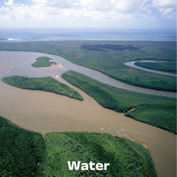
Water
Water Quality: Detect pollutants, algae blooms, and nutrient levels
Flood Risk: Predict and assess flood-prone areas. Industrial Compliance: Ensure regulatory adherence for water use.


Insurance & Finance
Accurate Risk Assessment
Assess risks for property damage
Analyze natural disaster risks
Improved Underwriting and Risk Management
Better risk pricing
Enhanced decision-making
Climate Change
Tracks deforestation, desertification, and glacier retreat
Monitors emissions and predicts natural disasters
Credit Carbon Monitoring.
Application Examples
Governments and NGOs use data to track carbon emissions and other GHG
Study, monitor, and enforce environmental regulations


Soil & Mining
Mineral Detection: Map deposits with high precision.
Soil Health: Analyze nutrients and contaminants.
Environmental Monitoring: Track impact and guide land reclamation.
Cost Savings: Improve operational efficiency.
Infrastructure
large-scale, high-precision infrastructure monitoring by detecting material degradation, leaks, and structural changes before visible damage occurs.
Supports predictive maintenance in roads, pipelines, and buildings.
Enhances disaster risk management, and improves energy efficiency in urban areas.
Providing continuous, non-intrusive monitoring, to reduce maintenance costs and prevent failures.
.png)